I ventured in from an Emergency Access road and hiked down to the huge dam ruins. I then ventured back all along the river. Every step of the way was awesome!
Descending on the Access Road


 |
| ARC GIS map |
Arriving at the Former Dam
The old mill ruins are down a few hundred feet or so but I will chart that another day. The side ledges here were spectacular...


Historical Photo
 |
| Yep further downstream there was a former 60ft high dam! Details > |
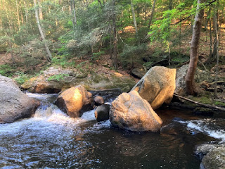
Walking upstream along the river


 |
| Yep - that's a natural sandy beach! |


Beautiful, Rich!!!
ReplyDelete