Saturday, November 29, 2014

Wintery Luther Forest and Shenantaha Creek Park

Thanksgiving Weekend at my Parents

Luther Forest
Although there was 6 inches or so of snow on the ground, I had the jones to mountain bike at Luther and was hoping that the local fat bikers had been in and rode the trails. I had my snowshoes in the back of the car as well in case the trails weren’t bike-able.  I was pleased to see the trails were rideable. - the fat bikers had been busy!

The only riding mistake I made was to try to ride up a short hill, standing up for extra pedal power. Without any weight on the back tire, I spun out big time. No traction-Oops!

All I ended up riding was the easy loop on the south side and a bit of the north side as my hands got kinda cold. Despite the overcast gray conditions, there was no wind so it was fun.


Shenantaha Creek Park
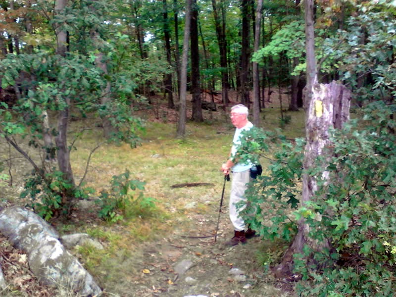
After my short jaunt at Luther I decided to head over to Shenantaha as I was curious about the hiking trails. I knew the scenery was pretty nice because I both hiked and rode the hidden trolley trail across the stream back in April and May.

Well, although the park was closed, the trails were open so I ...

 ...hiked back past the picnic area and playground and found where the trail started.  The signs detailed the history of the area...

and once in the woods,  the trail was nicely labeled with these markers.

Despite the recent snowfall, the trail tread was well traversed and easy to follow. The Creek had carved a deep gully and the path kept close to the Creek, at times perched 40 to 50 feet above the waterline.


Although strangely there was no signage at the actual location, I did find the old Flax mill

After hiking another 10 minutes or more, the trail descends down a rock strewn gully and reaches the water level.


All in all, it is a lovely place and I look forward to returning during the summer or fall and seeing the trees and plants in full bloom.

Sunday, October 19, 2014

New Trail Map Almost Ready..

What is it with the weather? Saturday was crappy and overcast and as expected, the trails in local parks were soggy and slippery.

Mr. Map Maven

Although I was itchin' to ride - I was fortunate in one way as I returned to Trumbull to hike and GPS the side trails for the map project I have been a bit obsessed with. Stop and go at every intersection would have been a bummer on the bike but this is how I needed to collect the GPS data so hiking in the morbid weather was actually productive!

I walked in from Whitney and tried to GPS every worthwhile side trail. I think I ended up with 50 or so mini "workouts" as Map My Ride calls them and was there for about 5 hours!

There were a few brief moments of sunshine but the park was empty--although I  saw a family of 5 deer in the Serengeti and (of course) squirrels galore!

Despite the gloomy weather I was able to capture a few good photos...
Lover's Lane :-) 
Snake Tree - Right off the trail in the Serengeti 
Maybe it should be renamed the Jungle -
"Serengeti" implies grasslands not dense understory and small tree growth!
Recycling at Work...
Around every corner in the Valley a new massive outcropping awaits! 
North Bridge view of the Pequonnock River 
The Rail Trail in the Autumn - tis beautiful..

GPS Trail Map

The map is almost ready - there a just a couple of trails I need to add.  As mentioned, it will eventually replace the FCNEMBA map found here >. The interactive legend will be made available on a large version on a second page.

For those of you who are curious, the map in development can be viewed here > 
This a a temporary link only.


Sunday, October 12, 2014

More Trumbull GPSing...

It was crappy weather wise on Sat but I went in late afternoon and hiked while GPS-ing, starting from the south to north this time. Strangely there were some serious connectivity issues at the south end but once I finally got that settled, I trekked the White Trail and returned on the Blue Trail.  By carefully doing each subsection as a separate GPS for a more precision in the Data Sets, I ended up compiling 30 Plus GPSs! I am using a cheapo Verizon tablet and Map My Ride and it is working out very well  - surprisingly!

Here are the results of the Google Composite Map so far (screenshot).

It was nearly dark at the last stretch of the Blue and my plans for doing more of the Secondary Trails didn't happen. My main concern were the trails just north of the Serengeti and the Central Maze trails, Once I get the majority of them on this map, I will post it on the FCNEMBA site and add some details on utilizing the built in interactive features...

Sunday, October 5, 2014

GPSing pValley - ...Carriage Road Remnants

Today--considering the monsoon we had yesterday--I went out to Trumbull (Pequonnock Valley) to hike and GPS trails instead of biking. 

I intend on remapping the FCNEMBA Google map of the Park but doing each blazed trail one at a time. Eventually I will GPS the side trails as well. Very tightly organized data sets separated for each trail will give me more precise control over all the data points. So I hiked in from Whitney and started GPSing (1) the Red Trail going south.

As I was traversing the Red, I finally photographed the faintly discernible remnant of an old carriage road, off of the red trail. It is down the hill after you cross the fire road going south. 
(the view here is looking southeasterly)
After I reached where the Red ends at the White, I (2) returned north on the Yellow. I ran into Kevin and his dogs right before the big climb up to the central maze and he joined me for the trek from there. Sadly something crapped out before the last stretch of the Yellow but I can GPS that next time when I will go in and do the White And Blue.

A screenshot of the map so far:
 it will-when completed- replace this map >


Monday, September 29, 2014

The Alplaus Kill is Beautiful!

[ Yeah it's not mountain biking  - but it belongs here considering it was a trek with my son...]

My son and I took a quick jaunt down to the Creek near my parents house on Sunday. We found a new trail carved out by an ATV and hiked south for a good while. I used to come down here as a kid but the trails at that time led north towards Little Troy. This hike was great because it was mostly "new territory" for me.
My son's butt! He's climbing a tree...
Picture Perfect!
Another Postcard ready photo!
A small tributary
We took our chances on following some ATV tracks that led away from the stream and into the woods. I had a feeling they would eventually loop back to near where we started.

Well I was right but there was a few very swampy sections that felt like quicksand!

Nevertheless it was great fun being back out in my childhood stomping ground sharing an adventure with my son.

Colonie Gets the Bulldozer :-(

I was forewarned the last time at Luther Forest that the Colonie Trails may “disappear soon." Sure enough - the far east side of the trail system is now bulldozed away to make room for a housing development.

I usually head in on the far eastern trail and try to loop around the outside trails first but NOPE - they no longer existed. 


Interestingly, I had some photos from back in 2012 and I have built a couple of before and after comparison shots.


 It was a very strange experience riding on these now useless dead-ended trails seeing the sunlight blasting thru and being surrounded by clearings.

Oh well - it's not quite the "end of an era" (yet!) as there are still some great trails to the east side of the ravine that have not been plowed under and thankfully the west side of the ravine is still intact!

Saturday, September 20, 2014

Huntington Park - Fun Loop

Stratocaster, South Park, South Pond and back on Stratocaster - A rigorous hour of fun :-) Enuf said...
Huntingotn Park - South Loop

Saturday, September 13, 2014

Pine Mountain (Scottish Tour!)

Bennetts Pond/ Hemlock Hills / Pine Mountain

Ridgefield /Danbury CT

Interactive Map > 

It was a grey and overcast day with a forecast of rain and I didn’t get started until about 12:15.  I wanted to check out Yellow Trail in the Pine Mountain Section of the park. I opted to park at the end on Pine Mountain Road and once I realized I forgot the batteries for my camera I decided not to bike but hike in instead. At least I would have the crappy camera on a tablet I had with me rather than nothing...


Hiking--rather than biking--turned out was a wise decision in the end… I first trekked straight south from the parking lot (green arrows) and marveled at the huge descent and ascent. I only realized when I got to the Blue Trail intersection that I went the wrong way  I had been here before a few weeks ago). DUH!

But I trekked back to the car and chatted with a hiker in the parking lot. Turns out I got off to a rough start when I asked if he was English (He had a strong accent...) -- Nope he was Scottish!  Fortunately he didn’t hold a grudge and offered to hike with me around the Yellow as he had been hiking here hundreds of times and knew the park well.

Well he was a chatterbox but quite endearing with his storytelling and wry Scottish humor! :-) We hiked in, taking the Brown Trail detour and stopped at the Overlook. Sadly, it was overcast but John pointed out where you could see Long Island Sound in the distance.

As you can see below, the photos came out pretty crummy. Although it was overcast, the real issue was it was very difficult to hold the tablet steady enough to get a sharp picture, Oh well - checking the camera to ensure it has batteries is on the "before I leave home checklist" from now on.


Once you reach the Overlook, the forest is fairly clear of an understory and the trail is marvelous - traversing slick rock and a few rocky sections here and there but it is mainly a flowy trail curving thru grass and/or pine needles.

I noticed some square rocks off the the side - wondering if they were some kind of surveyor remnants or whatever... (??)

A little later I noticed this interesting ladder (a deer hunter platform?)

John offered to take a photo of me next to a fallen tree

The whole area is peppered with all kinds of enormous glacial erratics - pretty amazing when you take note you are on top of a mountain!

 John was strong but not strong enough! :-)

A short bushwack took us to the remnants of an old airplane tower. There are four footings at the top of a hill. I reckon with the Danbury Airport just north of the mountain - this was an important signal tower for low-flying planes...

 Another interesting surveyor's stone I reckon, right off to the side of the trail.
Finally we arrived at the chimney ruins - sadly half the size as it use to be John tells me due to vandals tearing down the top and use the large rocks for a fire pit. Damn you - this is priceless history.... [see historical photos > ]
This was Charles Ives' hang out - he loved the woods as well :-)

Super Short Video (Highlights)

When we got 3 minutes away from the parking lot on our jaunt back - it started to pour. I'd call that a lucky break!