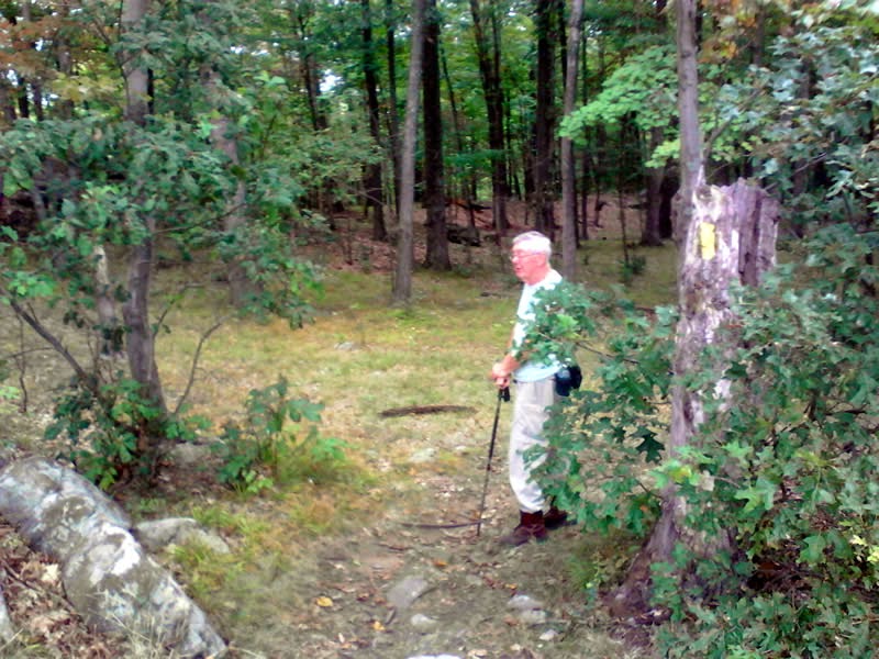
[ Yeah it's not mountain biking - but it belongs here considering it was a trek with my son...]
My son and I took a quick jaunt down to the Creek near my parents house on Sunday. We found a new trail carved out by an ATV and hiked south for a good while. I used to come down here as a kid but the trails at that time led north towards Little Troy. This hike was great because it was mostly "new territory" for me.
My son's butt! He's climbing a tree...
Picture Perfect!
Another Postcard ready photo!
A small tributary
We took our chances on following some ATV tracks that led away from the stream and into the woods. I had a feeling they would eventually loop back to near where we started.
Well I was right but there was a few very swampy sections that felt like quicksand!
Nevertheless it was great fun being back out in my childhood stomping ground sharing an adventure with my son.
I was forewarned the last time at Luther Forest that the Colonie Trails may “disappear soon." Sure enough - the far east side of the trail system is now bulldozed away to make room for a housing development.
I usually head in on the far eastern trail and try to loop around the outside trails first but NOPE - they no longer existed.
Interestingly, I had some photos from back in 2012 and I have built a couple of before and after comparison shots.
It was a very strange experience riding on these now useless dead-ended trails seeing the sunlight blasting thru and being surrounded by clearings.
Oh well - it's not quite the "end of an era" (yet!) as there are still some great trails to the east side of the ravine that have not been plowed under and thankfully the west side of the ravine is still intact!
It was a grey and overcast day with a forecast of rain and I didn’t get started until about 12:15. I wanted to check out Yellow Trail in the Pine Mountain Section of the park. I opted to park at the end on Pine Mountain Road and once I realized I forgot the batteries for my camera I decided not to bike but hike in instead. At least I would have the crappy camera on a tablet I had with me rather than nothing...
Hiking--rather than biking--turned out was a wise decision in the end… I first trekked straight south from the parking lot (green arrows) and marveled at the huge descent and ascent. I only realized when I got to the Blue Trail intersection that I went the wrong way I had been here before a few weeks ago). DUH!
But I trekked back to the car and chatted with a hiker in the parking lot. Turns out I got off to a rough start when I asked if he was English (He had a strong accent...) -- Nope he was Scottish! Fortunately he didn’t hold a grudge and offered to hike with me around the Yellow as he had been hiking here hundreds of times and knew the park well.
Well he was a chatterbox but quite endearing with his storytelling and wry Scottish humor! :-) We hiked in, taking the Brown Trail detour and stopped at the Overlook. Sadly, it was overcast but John pointed out where you could see Long Island Sound in the distance.
As you can see below, the photos came out pretty crummy. Although it was overcast, the real issue was it was very difficult to hold the tablet steady enough to get a sharp picture, Oh well - checking the camera to ensure it has batteries is on the "before I leave home checklist" from now on.
Once you reach the Overlook, the forest is fairly clear of an understory and the trail is marvelous - traversing slick rock and a few rocky sections here and there but it is mainly a flowy trail curving thru grass and/or pine needles.
I noticed some square rocks off the the side - wondering if they were some kind of surveyor remnants or whatever... (??)
A little later I noticed this interesting ladder (a deer hunter platform?)
John offered to take a photo of me next to a fallen tree
The whole area is peppered with all kinds of enormous glacial erratics - pretty amazing when you take note you are on top of a mountain!
John was strong but not strong enough! :-)
A short bushwack took us to the remnants of an old airplane tower. There are four footings at the top of a hill. I reckon with the Danbury Airport just north of the mountain - this was an important signal tower for low-flying planes...
Another interesting surveyor's stone I reckon, right off to the side of the trail.
Finally we arrived at the chimney ruins - sadly half the size as it use to be John tells me due to vandals tearing down the top and use the large rocks for a fire pit. Damn you - this is priceless history.... [see historical photos > ]
This was Charles Ives' hang out - he loved the woods as well :-)
Super Short Video (Highlights)
When we got 3 minutes away from the parking lot on our jaunt back - it started to pour. I'd call that a lucky break!
My last ride of my Vermont Trip was at this spot in Waterbury. You ride over the railroad tracks (an Amtrak Train whizzed by right before I headed in!)...
and then you ride thru this tunnel that goes underneath the Interstate Highway.
The only signage at this park is the kiosk at the bottom of a LOOOONNNGG slog up the green trail called Permission.
I was lucky to catch the mid morning sun rays beaming thru the woods - it was beautiful.
Stupid me got up quite a ways when I realized I didn't have my helmet. So I climbed the steepest section twice!! Truth be told, it was brutal for me as it was 90 degrees plus and super humid as well.
So I probably hiked 70% percent of the long climb. Once you reach the trail intersections, it is not quite as steep but it is a relentless climb way up to the top.
This short video is not at the top (although I thought it was in my narration)
As the video states, I opted to take the Yellow Trail and it still continued up the mountain! Fortunately this was more typical singletrack with switchbacks and roots galore and the grade was not as relentlessly up (some short flat and downhill spots for a change).
You reach this clearing (the trail skirts the edge) which perhaps is the actual top of the mountain! Satellite View >
The way down the Yellow was awesome - well benched with artfully sculpted berms. It was a speedy scenic descent.
The section thru the pines was awesome!
Further down, the trail skirts the edges of small ravines - twisting and turning to follow the edges...
The whole ride only took an hour and ten minutes and probably the descent was a mere 20 minutes -- but twenty minutes of pure ecstasy (especially after the long torture of the ascent! :-)
After riding the Island Rail Trail in Burlington (late morning), I grabbed lunch in Burlington and headed back to Stowe and got started here at 3 PM. I was here 4 years ago with my son back when it was still a purposely semi-secret place. Well things drastically changed (for the better!) and now--not only is the place recognized as “official”--but there has been considerably more trails added.
Simply put - it is freakin’ awesome...
Entrance on Mountain Road
After a strenuous but do-able one-way climb thru a series of switchbacks, you get to an intersection and your choice of riding fun begins...
Great Singletrack!
the climb...
well labeled intersections
(straight ahead - the climb to the "chair")
I opted to head up to the green chair, which I remembered from my previous visit. It's at the top of the first mountain. A chair from a ski lift was randomly hung here years ago and by looking thru the chair you can see the Mt Mansfield ski trails. Sadly that section of the photo got bleached out by the sun :-(
the "chair"
There are some rough hewn rock outcroppings here and there which you can ride (I simply chose the B line) and there is constant climbing and roots and twists and turns everywhere you go.
terrain features
Much of the higher ground is a tall pine forest so you have that lovely lack of undergrowth...just a lush bed of pine needles on the ground all around. All these side trails are "old school" and fun but challenging to ride.
nice "old school" trail
The trail aptly named "Bridgey" has quite a few boardwalks to traverse.
check out the bridge/boardwalk
After finding the trail "Zog", I planned on heading out (I was bushed!) but noticed the sculpted trail off to the side that wasn't on the map. Man... this was amazing! I--without even trying--end up flying down a series of huge sculpted berms and curves at probably close to 30 mph! I end up back on Zog and had to slog back up but it was worth it.
just made >> new flow trail - berms galore!!!
The rest of the main trail out-- on the Cady Hill connector-- once in the downhill section--was professionally sculpted as well and another fast bomb :-)
Lastly, the one-way out on Bear's Trail seemed to last forever. A series of switchbacks took me back down to the parking lot and I realized just how much the climb was to get into the park! Phew! For a change, it felt like I had done more descending then ascending!
Once in the parking lot, I chatted with another rider who said the sculpted trail I rode next to Zog's was just finished yesterday! Boy was I a lucky dude :-)
I am staying at a Trapp Family Guest House with family for a few days and I got to riding at around 9 am. These single track trails are really great! A good amount of well thought out climbing with switchbacks gets you up a couple of hundred feet but the loop itself continues "the theme of up and down" as there are many switchbacks on the loop section as well.
Rocks, roots, twists and turns and many climbs and descents make it a challenging place to ride but very do-able. There is more single-track to explore that goes further west and up - hope to get to that as well.