Showing posts with label East of Keeney. Show all posts

Friday, August 8, 2025

A Triple Header!

It was a beautiful day out today: sunny and not too hot (for a change). In the morning I rode

1 - Smith School

The Trailforks map is still a "Work in Progress"

Smith School Trails 


2- East of Keeney (EoK)

Then I rode some of Eok. Sadly there were a lot of blowdowns that we'll need to clear out...


3- Case Mountain

In the afternoon I rode Case Mountain, this time with the intention of checking out the trails that parallel Coop Road since I have never ridden those...

Trails I rode:

  • Coop Road
  • Warlock
  • The Reflex (this is a tough trail!)
  • Coop Road
  • Warlock
  • Coop Road
  • Rope Swing 
  • Coop Road
At Buckingham Reservoir

Friday, May 30, 2025

Saguaro - Old Bench Trail loop finished

Today Al Tinti and I finished clearing up the lovely trail along the Salmon River ravine. It turned out to be a beautiful day and the full loop will be fun to ride (see rough trail map at bottom).


The GPXs have been submitted to Trailforks so hopefully soon there'll be a nice map to entice and guide riders. Rough sketch map below includes the water line (which is wet and nasty to ride all year long!) 


Friday, April 11, 2025

Lidar Exploring - EoK

Weather was overcast and the woods were soggy so I decided to do a little "lidar exploring" on foot (rather than mtn. bike).

Relics from the Past

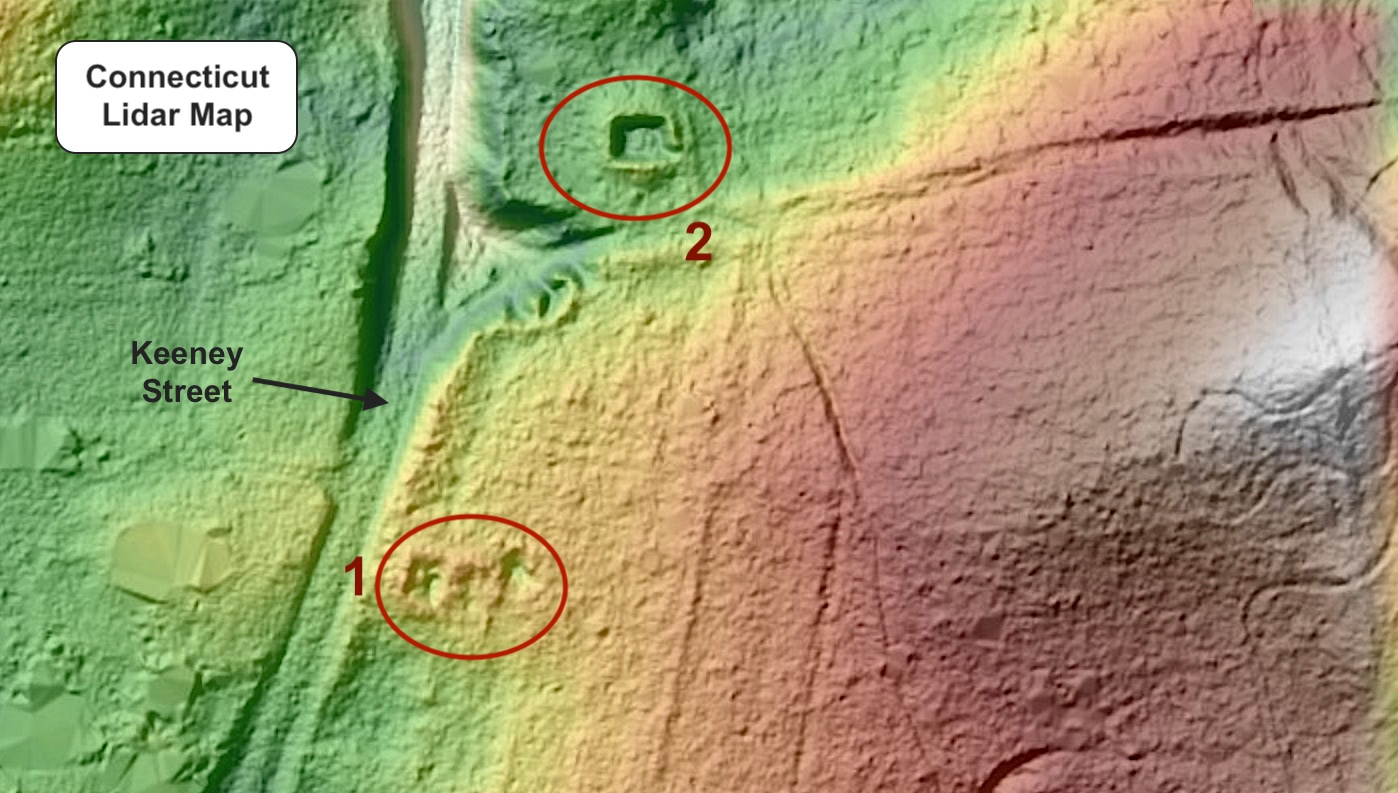
These squarish protrusions on the lidar map intrigued me so I hiked north from Howe Street to find them.

There wasn't much to see of #1 but #2 was pretty obvious.
#1
#2
It turns out both spots are on 1893 topo map - kinda cool!!

Old Trail

Many old legacy trails are visible on the lidar map as well - I may be updating some of these for mtn. biking so the lidar map is an excellent resource!
"Special Spot"


Tuesday, March 25, 2025

Potential - EoK - NoH

 East of Keeney - North of Howe (EoK - NoH)

I took a walk through an unexplored forest area - checking out features that might be nice for a future mountain bike trail. Keeping a good distance from the myriad of dirt bike trails is an important criteria.

The dry stream bed has great potential!
Enlarged area

1 - Dry Stream Bed


2- Old Road/Trail


Monday, October 14, 2024

EoK Water Line Alternative

There is finally an alternative from riding the nasty "always wet" Water Line Trail when  entering from the Keeney Street side :-)

There are some beautiful spots along the trail...
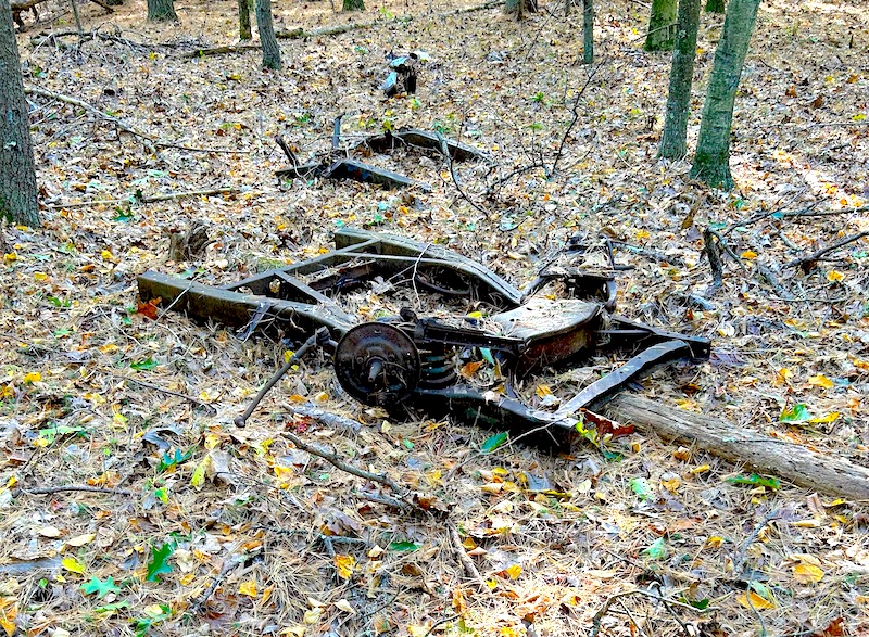
...and of course there's the rusted car ruins!
Here's where it starts on the Keeney Street side (right off the Water Line trail)


Thursday, February 22, 2024

EoK Snow Hike

I was finally feeling better after my spell with COVID so I went on an afternoon hike East of Keeney.

I went in at Heritage Drive and hiked the entire parcel south of Howe. Lots of folks have been using the trails as well as a dirt biker.

Tuesday, December 12, 2023

A sunny hike (EoK)

Took a sunny hike on the trails south of Howe Street today - things are looking good!


Monday, October 2, 2023

No More Rain - Finally!

Took a short late afternoon hike - South of Howe - East of Keeney.  The stream was high due to the incredible amount of rain we've had recently but the trees are starting to change color - mmm... mmm...


Saturday, June 17, 2023

Dirt Bike Widening - Yikes!

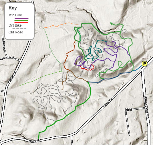
It was a cloudy and nasty humid day but I decided to check out North of Howe because I knew the dirt bikers had leaf blown their trails. Since I leaf blew a few of their trails for mountain bikers I was curious. They must have got the idea from me! Yikes - its like a wide roadway in there now :-(

As this map indicates, knowing where to bike on pedal-friendly trails is now confusing...