Showing posts with label Abandoned Road. Show all posts

Friday, December 30, 2022

Coop Road - Case Mountain

In keeping with my recent "Abandoned Road Exploration" theme, I road Coop Road at Case Mountain today. The weather was amazing for this time of year - in the 50s and sunny so it was a pleasant ride. My destination was the former bridge...

The purple arrow indicates where I veered off the old road and had to ascend the powerline trail instead.  It looked pretty daunting but I made it without dismounting!

The first stretch until the power lines is pretty straight ahead -- I've ridden it before.

Yikes - -the powerline ascent!
Back on the old road...
I made it the the bridge- yeah!
To the east is what appeared to be remnants of an old dam...
...and another (nicer) trail
On my way back - I snapped a photo of the powerline hills

Thursday, December 29, 2022

Remnants of Country Club Road

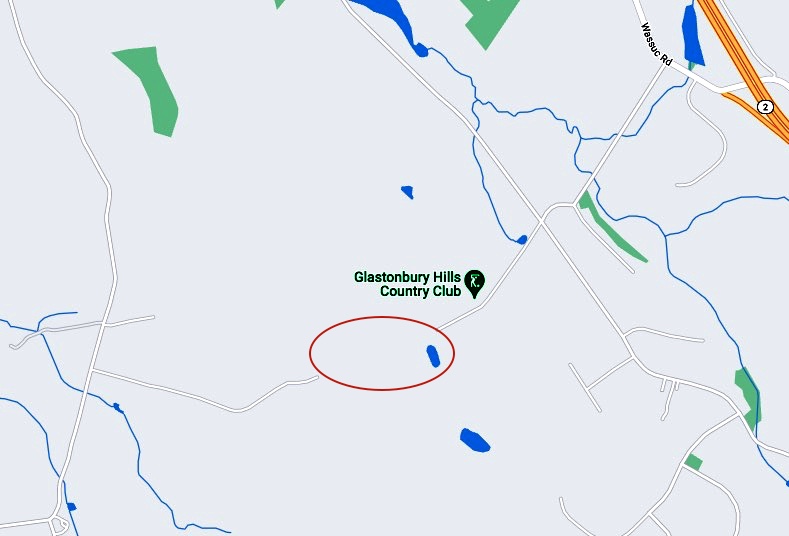
Today I continued on my old road sleuthing project and checked out the remnants of Country Club Road. There are now two dead-end paved sections because apparently around 1972, the town decided to abandon the middle section of the road and now its just a washed out mess but interesting nonetheless.

Location
1869 mpap

I walked in from the country club side and headed west...

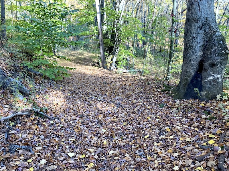
Its pretty much impassable now - even by mountain bike but its still clearly defined with rocks lining the edges in spots.
Once at the other end of the washed out remnant I turned around
Crude 4-photo panorama...
The sunlight on the way back was nice...
Off to the side was a boulder "garden" - glacial erratics - a vivid reminder of the mighty ice age

I then ventured over to the Hollister-Whitehouse Preserve...

Further Info

Country Club Road (Hollister Road)

Wednesday, December 28, 2022

Old Road Sleuthing

East of Keeney Street there appeared to be vestiges of an old road. Curiosity got the best of me today as I went there to check it out.

Although it dissipates after a short while--it WAS a road...As the photos below indicate, this stretch look manmade (but long abandoned). After surveying the area, methinks it was probably created when the road crews were upgrading Keeney Street and needed fill. 

After the road disappeared into nothingness, I walked a bit along the ridge. This would be great for mountain biking!
On my way back out, I snapped a few more photos.This hollowed out area could have been where fill was dug out for road construction.

Thursday, October 20, 2022

The Old Road Beckoned...

After yesterday's hike and visual confirmation of the old road, I decided to go back and visit the west  side of the stream and look for the crossing. 

Green Rectangle is enlarged below
I parked at the med center at the end of Nye Road and bushwhacked thru the woods
The first thing I came to was an old ATV trail
I crossed the phone/power line clearing and bushwhacked thru more woods eventually finding the old road
After hiking back westward out to the clearing again- I started eastward on the old road
It was a gully
and there was another old road parallel to it, just a bit to the south
Looking back westward you can see how the two roads converged
I gingerly made it across the stream on the stones...
then hiked a bit more on another road remnant...
and found the old road gully. Here's a photo looking eastward of the old road on the eastside of the stream
Sure enough I found the actual old crossing, and photographed the stone abutments - how cool!
Parting shot of the streambed looking south