Tuesday, November 23, 2021

Keeney "Tour"

Nov. 18th

Chillin'...
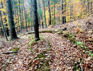
Ridge Trail - ready!

Nov. 23rd

My hiking pal Kevin was up in the area so he stopped by late afternoon for a hike. It was freakin' cold and windy but at least the sun was out!

Oh the green! ....  <wink>
We gingerly hiked down a really steep incline to get to the stream but it was pretty nice!
Last rays of sun...

Saturday, November 13, 2021

Still Curious - North of Howe

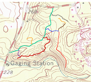
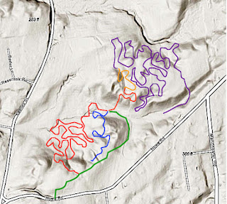
I knew there were a lot more trails north of Howe I hadn't yet explored so since the weather was great today I returned to check them out. Once again I parked on Keeney and hiked up on the main artery to get to Howe. On the way, I GPS'd  a couple more trails off to the east...

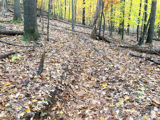
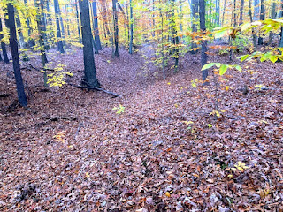
and snapped a couple of autumn shots as well.

North of Howe

Once I was north of Howe, I went straight instead of turning at the first intersection. This interesting remnant was on the way there...
I started the GPS going at the point where I went straight instead of turning and had quite a hike this time! The weather was really pleasant although the leaves were still wet and somewhat slippery from the rain last night.
Much of this seldom used trail are trenches on really steep fall lines which obviously encourages erosion. Methinks they may have been created by dirt bikers ages ago who have since moved away.
This goes straight up the hill..
 ... and the trail went on and on forever!
Interesting remnant here - maybe it was the floor of a kid's log hut?
Hey - who's that? :-)
Further on,  this section appeared to be maintained at some point - notice the sawed deadfall.
It went on and on and up and down for seemingly forever...
I finally bailed here near Howe Street and bushwhacked up to the road.
Trail Summation

 Curiosity was satisfied (at least for a while!)

Thursday, November 11, 2021

Never-ending Switchbacks - Keeney Krazies

There was a nice splash of orange near where I started my hike (Same spot as previous treks this week)
I traversed the main artery up to Howe Road and then started up the GPS.
The main trail was easy to follow at the beginning. 

Switchbacks

I started to descend the switchbacks (craziness begins...). They were very steep up and downs that seemed to never end.  Berms and often deep trenches defined the trails and the soil was often very sandy.
The switchback section elevation:

Finally, the trail became flatter and I soon arrived at the bottom of the ravine--at the dry stream bed. The trail took sharp right at the dry stream bed.
After a bit a more flat terrain, it ascended very steeply once again then descended to a couple of spots where trails intersected. I'll need to come back to this area to GPS things better. It's actually a little nicer than the long series of uphill/downhill switchbacks I just GPSd.
At this point I really kinda lost my sense of direction and was anxious to get home - it was starting to get dark and there were too many choices of more trails to explore and GPS!
I ascended another steep "trench"....
At this point, I decided to stop following the trails and figure out the quickest way to get back to my car. Using the GPS on the phone - I bushwhacked through the woods and got on Howe Road. Once I figured out the direction to take, I walked back to the car on Howe and Keenney Roads. Yikes -  at the car I found my key fob fell apart - the missing cover piece was somewhere back in the woods!!!
I was able to open the doors with the fob's key and gingerly inserted it to start the car - it worked! Phew...

What a crazy trek - I think I might have been cursed today!