Saturday, October 23, 2021

At the South Glastonbury Ferry

Late afternoon, I  was down at the ferry side to chill a bit and I just happened to catch one leaving!

I noticed some determined fisherman with tents no less on the little peninsula.
Ages ago, a few hundred feet downstream was a freight dock. There not much left to it now but a single piling emerging from the water...

.. and a trek further southward was more of a plant tunnel than a path!


Ferry History Details (previous visit)

Friday, October 22, 2021

Center Springs Park

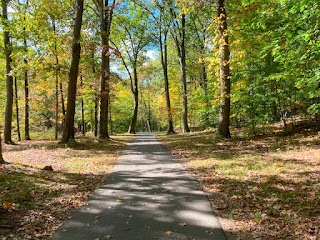
I toolk an easy walk in this lovely park in Manchester today
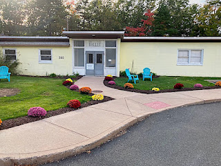
There's a nice ravine...
...and a scenic walk down to the pond
Disc Golf map!
The pond - wow!
Beautiful!

You can walk back on the other side of the stream :-)


Interesting article on the Park's History (PDF)


Thursday, October 21, 2021

Repurposed Nike Missile Control Site

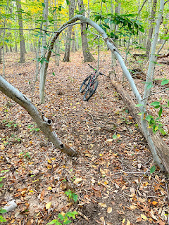
It seems the area east of Hartford is riddled with abandoned missile sites - I of course had to check them out! The weather was beautiful today so I went for a quick mountain bike exploration...

Hercules was a type of Nike Rocket

The Ride

Red Dashes indicate the route I took--Purple arrows indicate the way out...

Nike Recreation Center

The Nike Site, from 1957-1961 was a U. S. Army anti-aircraft defense site. This site was known as HA-25,. Nike missile sites consisted of two separate parcels of land -- (1) the launcher area and (2) a "battery control" area that contained the radar used to track hostile aircraft and guide the missiles to their targets. This site - now a recreation center  was the control area for the launcher area which I visited back in July


Most of the original buildings are still standing and many of them are in pretty good shape.
Even the Connecticut Ballet is here!

The pump building and water tank are located up on the hill behind the main buildings near where the radar dishes were situated.
Former Pump Building
An overgrown paved road leads down a hill

The huge (water?) tank is down the hill a bit.

The overgrown asphalt former road veers to the right and eventually connects to Faith Circle.
I veered off the asphalt (to the right) and found the trail - beneath the leaves: a barely visible carriage road.
Eventually I ended up at the power lines. Man, it seems almost every trail in this area intersects the power lines!
Finally I turned back and went up a true single track to get back to where I parked. It was a ridiculous steep uphill - if I visit again, this trail will be bombed down the other way!

Further Info

Tuesday, October 19, 2021

Curiosity...

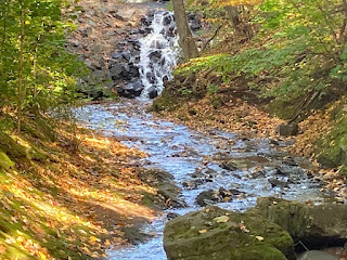
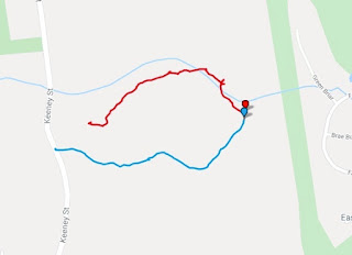
Every time we drove by this trail entrance I was curious about it so today I hiked it.

Although initially I thought it might be an old abandoned carriage road, I believe its merely a water line when I saw the manholes:
At this juncture the main water line went straight up the hill and I turned left onto a very obscured single track...
...that soon paralleled a ravine. It was very scenic.
I decided to turn around here because basically the trail disappeared but the late afternoon sun made everything look very enticing...

...and I even spotted a small waterfall on the way back!
The late afternoon sun really was nice!

GPS Map of the hike

Blue route is the wide water line. The red route is the obscure single track. Please note the red route is a bit off - I didn't cross the stream but otherwise it was cool to see the stream (Salmon Brook) and the topo relief of the area...


Wednesday, October 13, 2021

Hollister-Whitehouse Preserve

 I took a short hike this afternoon that surprisingly had a bit of a climb but you were rewarded with a view! Hollister-Whitehouse Family Nature Preserve is very close by and using the AllTrails app, I checked it out.

It turns out the kiosk sign has more detail than the AllTrails map but even this map missed a few trails in the north section.

The Hike along the Stream

I parked in the Tall Timbers Road entrance and hiked the park in a counter-clockwise direction. The trail follows a small creek for quite a ways before ascending the hill.
There was a short but interesting rocky section. Since I have been scouting out old feldspar quarries in the woods recently, this section looked uncannily like slag from an old quarry but I think I conjecture too much and it was probably just nature's geological randomness :-)
More trail before the big climb...

The Climb

It was a bit of a slog up this hill (250 ft or so!) but the view was cool.

The Vista

The side trails were not marked on the AllTrails map
There was a nice view of Hartford in the distance. I imagine on a clear sunny day - it must be even better!

The Descent

There were quite a few other side trails off to the north (not on the maps!) which I wandered on for a bit. The final descent had quite a bit of rocky outcroppings.

All in all the hike was more interesting than I expected and I can see returning--all seasons--to enjoy the views and forest.