Showing posts with label Wooster Mountain. Show all posts

Saturday, January 13, 2018

Exploring Pine Mountain

The early morning crappy weather (overcast, sporadic rain) turned nice (sunny!) after a couple of hours.  We came in via Bennetts Pond / Rt 7, and after exploring the stream crossing, we headed along the south side of the pond then over the White Trail and up the first hike-a-bike Red Trail. Most of the rest of the time was spent exploring the hillsides "off the beaten track".

The highlight of our "tour" was finding quite a few more natural overlooks on Pine Mountain - the terrain there was amazing!

Stream Crossing

 Bennetts Pond :-)


Heading Up the Red


At the Kiosk

Click to enlarge

Exploring...


Wicked Rock Gardens


Many Overlooks (ooo yeah!)

 Hidden Stream

As we traveled eastward over an incredibly picturesque ridge, we had to dip into this ravine and cross this raging stream. I can image this spot must be heaven in the summer greenery...


Conclusion

The Pine Mountain area is amazing - it's no wonder Charles Ives spent a lot of time there! LINK

Sunday, March 26, 2017

Wooster Mtn Snow Slog

The weekend was rainy and dreary but I decided to head out Sunday afternoon and continue my GPS hiking quest.

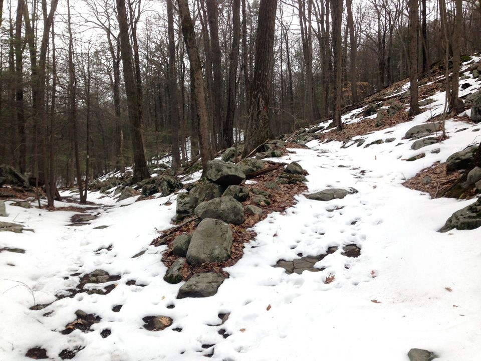
This time I parked at the Gun Club lot and first headed up the old road in the back. It was blazed white. There was snow on the ground, wet and half melted, but most of the time the trails were discernible.

Carriage Road Ascent

Old Carriage Road Ascent
this White Trail ascent is mostly an old carriage road
(rarely used by bikers)
At the top of the hill where the Yellow meets the tech trails off the to left

This stretch of the Yellow was an old carriage road as well
(you can see it on old Topo maps)
Looking back at where the Red intersects the Yellow
Ah... remnants of yesteryear..
The old carriage road continued straight (now gated since it is someone's back yard)
At this point--without blazes and a few inches of snow on the ground--I wandered up the ridge (curving to the left) but lost where the trail continued so I headed back to the Red intersection.

On the Red

This is a great trail--perfect for XC--not too much tech...
This is a nice XC trail and I can't wait to ride it
There’s a red trail here (a shortcut to the Ives) but I wandered up the stone tread on the left and got lost. This was apparently a tech offshoot. I believe the trail actually heads down to the right (some scattered blazing) but it was getting late and I decided to play it safe and stay on the trails I knew.

On the Ives

There's a section on the The Ives Trail which is mighty rocky and steep

Final Descent 

I headed out on the short and and steep White descent to the Gun Club
It was tough not to slip and slide on the section as it was very steep
Looking back up - confirming it was blazed White

Whew!

It was a good thing I parked in the outside lot as the gates were locked shut on the inside lot. The silence in the air indicated the Gun Club had been closed for a while.

Despite the soggy hiking boots and the occasional sprinkle of rain while in the park - it was good to get out a climb and explore...

Saturday, March 11, 2017

A Return to Pine Mountain

It was bitter cold today but I decided to bundle up and return to GPS trails at Pine/Wooster Mountain. I was still unfamiliar with the northwest section of Wooster so that was my goal.

I parked at the Pine Mtn. parking lot and slogged up and across the Yellow Trail. I took the brown trail alternative on the climb up to Pine Mtn.
Pine and Wooster Mountain Trails
The official entrance to the trail is a bit down the hill from the parking lot,

 Brown Trail Alternative

Here is where the Brown Trail intersects with the Yellow Trail

 Back on the Main Yellow At the Pine Mountain Summit

Once you get to where it levels off, it is really nice!
The Yellow Trail at Pine Mountain
Views of Bennetts Pond as you descend (going easterly)
The Yellow Loop turns off to the left - I descended on the right

Red Trail

At short distance down, I veered off to the left on the Red and continued on--a little later, turning to the left where the Ives veers right.
Staying on the Red
Ives veers to the right - the Red veers to the left

 At the Tree Burr Intersection

A very distinctive looking tree burr (it reminded me of a Chinese pagoda) was the landmark at the intersection of the northward trail(s) I wanted to explore.

Trails and NOT A TRAIL!
Tree Burr - Main trail makes a hard right here
Much of this area was not only not blazed but rarely traveled so finding the trails was difficult.
The big rock was on the left - its a great landmark for this area!
After a focused attention on staying on the trail - it traverses a ridge, I ended up back by a pond and near a building. At this point I no longer could figure out where the trail was...
 ..and ended up taking a crazy detour down into the valley and back up again (purple dashed line on map). The big rock (mentioned earlier) was the landmark that kept me from getting lost!
my crazy descent into the valley over these rocks...
 Lastly I scouted out another trail that ascends another ridge and right before the ascent, I saw this hunters (bird watcher's?) tree stand.

Conclusion

Sadly it wasn't a very productive trek as I am not so sure how valuable the GPSs I took will be. Nevertheless, it was good to get out off the house and hike a few miles. Despite the dire prediction of bitter cold wind, I had a down jacket and felt very comfortable!