Thursday, November 11, 2021

Never-ending Switchbacks - Keeney Krazies

There was a nice splash of orange near where I started my hike (Same spot as previous treks this week)
I traversed the main artery up to Howe Road and then started up the GPS.
The main trail was easy to follow at the beginning. 

Switchbacks

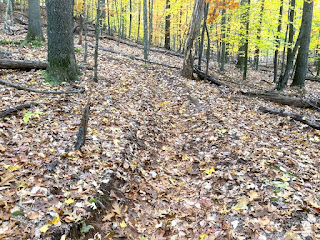
I started to descend the switchbacks (craziness begins...). They were very steep up and downs that seemed to never end.  Berms and often deep trenches defined the trails and the soil was often very sandy.
The switchback section elevation:

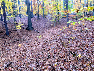
Finally, the trail became flatter and I soon arrived at the bottom of the ravine--at the dry stream bed. The trail took sharp right at the dry stream bed.
After a bit a more flat terrain, it ascended very steeply once again then descended to a couple of spots where trails intersected. I'll need to come back to this area to GPS things better. It's actually a little nicer than the long series of uphill/downhill switchbacks I just GPSd.
At this point I really kinda lost my sense of direction and was anxious to get home - it was starting to get dark and there were too many choices of more trails to explore and GPS!
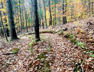
I ascended another steep "trench"....
At this point, I decided to stop following the trails and figure out the quickest way to get back to my car. Using the GPS on the phone - I bushwhacked through the woods and got on Howe Road. Once I figured out the direction to take, I walked back to the car on Howe and Keenney Roads. Yikes -  at the car I found my key fob fell apart - the missing cover piece was somewhere back in the woods!!!
I was able to open the doors with the fob's key and gingerly inserted it to start the car - it worked! Phew...

What a crazy trek - I think I might have been cursed today!



Tuesday, November 9, 2021

A Return to the Backwoods

I returned to the "abandoned" trails I scouted out on Sunday and GPS'd a few more. These were most probably created by ATV 4-wheelers ages ago...

To the right is Trail B which led down to the stream on a very steep downhill
By the stream
On the way back out...

Sunday, November 7, 2021

A Sunday Backwoods Trek

I came here once in the early spring and today was a great day to this time: document the trek!
This main trail looked like it might have been an old carriage road
There were a few obstacles along the way!
But nothing was insurmountable and I continued...
Until I ended up at Howe Road. It continued on but I turned around here...
The mid early afternoon sun was really nice amongst the trees
And Trail #3 ran along a really high ridge - the river was far below. This was single track and NOT an ancient carriage road
At the end  -  someone had a nice idea!
A side trail was even labeled!

Trail #7veered of the the right up a hill
And I ended my trek on trail #7 here - although it still continued (barely!) beyond the fallen log...

There are more trails here which I'll be back at some point to check out but at least now the main trails I've charted!


Friday, November 5, 2021

Giving a quick South Glastonbury Tour

I took my visiting friend Kevin to a couple of favorite spots. It was late afternoon and the weather was cold but things were still looking beautiful!

Brainard Pond Dam (a.k.a. Smut Pond)


Cotton Mill

The hike to get there
That's the old mill behind us...


...and the remnants of the upper 60 ft dam were a bit easier to see now with less foliage :-)
Kevin found a great spot -It might be nice to play my Native American Flutes here!
...and the way out was a stunning orange!

Wednesday, November 3, 2021

Autumn Colors (On The Way to Portland)

I had to capture a bit of the fall colors this year...

On The Way to Portland

Glastonbury
-short video-
Traveling south on Route 17


Quarry View

Looking beautiful in the afternoon sun.


Tuesday, November 2, 2021

Observations on my walk to vote

It was about a 12 minute walk to the voting area (the local elementary school). Observations along the way...

Red!!
The ubiquitous Power Lines - (future bike or hike!)
a sure give away that this pine grove was man-made
From my never-ceasing online research of local history I know there was once a quarry nearby. But clearly posted no trespassing signs prevented a closer inspection!
See the clearing? That's the former quarry

About the quarry

Curtis Quarry >

1910 Description:

"A feldspar quarry 2 1/2 miles northeast of South Glastonbury, near the road to East Glastonbury, is worked by a firm that uses the product entirely in the manufacture of abrasive soaps [Bon Ami]. This quarry is on the farm of Frank G. Curtis and consists of a single pit about 250 feet long, trending northeast and southwest. It is about 30 feet wide at the northeast end and narrows to 15 feet at the southwest end, having an average depth of about 20 feet.

"The material is quarried by steam drilling and blasting and is hauled by two-horse and four-horse teams 9 miles to the mill at North Manchester. Here it is crushed, first in a rotary crusher, then in a chaser, and is ground to requisite fineness in tube mills. Only the purest portions of the pegmatite are used, and the amount of quartz in the ground product will probably not exceed 10 per cent."