Sunday, February 28, 2016

Trumbull - North Bridge Connector Washout

Back on Feb 28th I spent a couple of hours Late Sunday afternoon fixing the stream washout at the North Bridge Connector. An amazing amount of water must have cascaded down the hill to pull this much dirt with it. That event ended up diverting the flow over to the connector trail and causing complete havoc. The wall we built back in 2010 (link >) wasn’t enough, due to the major amount of  topsoil dislodged, tossed and redeposited downhill.
huge washout - mega mud/dirt
thinner channel dig - barriers reinforced and created to route the water flow further downhill 
at the time, it appeared the trail might need rerouting...
I returned a month later (Mar 27th) and snapped a couple of photos. Amazingly, it looks like the trail has flattened out and a reroute is not necessary - just a thinning using leaf cover.
the narrowed stream bed
flattened trail just needs to be made thinner with leaf cover

Sunday, February 21, 2016

A return to Old Mine and Parlor Rock

Old Mine

I ventured back to the park today to finish up GPSing the trails but the damn app wasn't working correctly.  It was bummer when I got home and saw all the trail map data on the phone was wrong!

But I still enjoyed wandering around the park. I ran into a couple of friends of mine (both a biker and a hiker) and noticed a little more closely how much of the old mine remnants are still visible throughout the park.

As you ascend the west side of the hill, remnants of an old parallel mining road are clearly visible.

...and at the top of the hill--right after the carriage road turns eastward--is a huge area that looked like an open pit for mining. Sure enough, an old map I located online confirmed this area was known as the upper pit.
Many stone pilings and pits scattered across the entire park indicate previous mining activity and the sketch map above helps identify them. Interesting stuff for sure!

This knotted and burled tree caught my eye - it looked like the face of a gnarled lizard :-)

Parlor Rock

On my walk back to Whitney Ave, I stopped to marvel at Parlor Rock Falls. They were "full blast" today with all the meltwater.


Saturday, February 20, 2016

Back At Old Mine (Beautiful!) and confirming the Valley was an icy mess

Old Mine

I returned today to try and finish up the GPSing for the trail map I am building. It was gorgeous -- sunny and warm!. This time I had a replacement battery in my phone so that hassle was eliminated.

Even though most of the trails in the back were clear, I still had to scale this snowbank to get started!
Where I parked
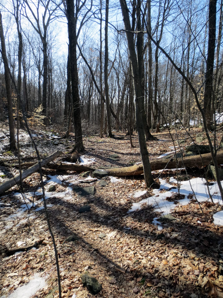
At the start of on of the trails I hadn't yet GPSd
A panorama of a 3-way trail intersection in the back of the park
There is an easy trail at the bottom on the hill in the back that parallels this fence along the back property line of Home Depot.
It ends up connecting to the carriage road at the mine cut on the west side of the park.

The carriage road double track was probably built and used during the mining days. It is nicely built up with solid stonework.
Looking uphill at the double track carriage road
Looking downhill at the carriage road near the mine cut
I retraced my hike to the top trail and this time located the loop that swings back north.
 Off to the side it looked like a pile of mine tailings...
The trail up top is really nice (especially in the sunlight).
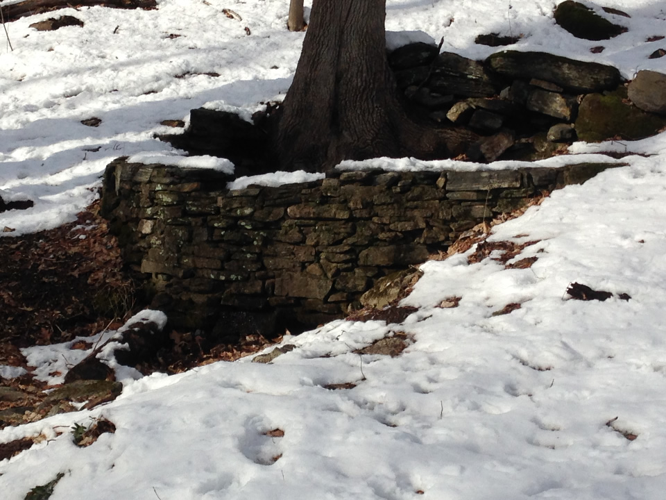
I wandered off trail a bit and loved this old wall...


Well the GPS glitched on a couple of trails (the thin brown trail is only a approximation) but it's 95% done... I can't wait to ride the park soon!


The Valley

After my GPS focused hiking at Old Mine Park, I drove south to Whitney Ave and hiked around the Valley a bit. Good thing I didn't bring my bike. It was super icy and muddy everywhere!
Even the Rail Trail was glistening with ice 
Many easy trails were tough to walk without crampons
(super slippery)
A bit a beauty nevertheless 
The way up to the Red Trail was a deep pond!
Lastly, the connector trail from the North Bridge to the White Trail is washed away - the rock embankment we put in a few years back wasn't enough... :-( The streamlet overflowed and cascaded over the trail...

It will be a while until the Valley can be ridden again...

Sunday, February 14, 2016

7 degrees on Valentines Day!

At my parents -- had cabin fever... I dressed warmly and ventured out for a few quick treks in the area.

Charlton Mill Pond Park

(off of Crane Road)

Tracks in the Snow
 Ice Chunks
 Path Thru the Pines
 The Old Mill Pond Dam
You still easily discern the main mill dam in the winter

Indian Kill

Quickie Hike on the Yellow Loop

Shorey Artist Cottage

Ballston Lake, NY

Final Days :-)

Sunday, February 7, 2016

Old Mine Trumbull Explorations - Part II

Today I returned to continue yesterday's trek -- hiking and GPSing the trails at Old Mine Park. I parked in the back, at the end of Corporate Drive and scouted out most of the rest of the park before my camera battery died. (It's an old phone so it seems 2 to 2 1/2 hours is all it lasts these days - bummer... )

There are some really nice XC trails in the back section.
My travels took me eventually down the double-tracked carriage road on the west side and by the old mine.
After making a full loop down to the bottom and back up again, I eventually circled onto a trail that goes to the very top of the main mine hill.
 It skirts the edge and is quite scenic, but...
... it ends up going straight down a 60 ft plus ridiculously steep incline (see below) which--needless to say--was insane to traverse in the slippery snow and ice. I nearly lost it a couple of times!
Suffice to say, this section of the trail is dangerous and marked on the map as dashes that eventually dissipate into dots. Perhaps there's a loop up top that I missed - I certainly hope so, as the rest of the trail up top was magnificent.

One More Ascent!

I ascended the east side double track one more time to GPS the trail that goes east over the stream...
and got a chance to take another photo of the curved dam. This time the snow had melted a bit so it was a little easier to discern the stonework from the photo.
 Lastly I snapped two large burls on the same tree. Poor thing!

Well the map is near completion. The trail farthest to the west needs GPSing and there are a few more I missed but progress is good :-)