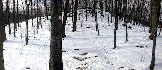
It was bitter cold today but I decided to bundle up and return to GPS trails at
Pine/Wooster Mountain. I was still unfamiliar with the northwest section of
Wooster so that was my goal.
I parked at the Pine Mtn. parking lot and slogged up and across the
Yellow Trail. I took the brown trail alternative on the climb up to Pine Mtn.
 |
| Pine and Wooster Mountain Trails |
 |
| The official entrance to the trail is a bit down the hill from the parking lot, |
Brown Trail Alternative
 |
| Here is where the Brown Trail intersects with the Yellow Trail |
Back on the Main Yellow At the Pine Mountain Summit
Once you get to where it levels off, it is really nice!
 |
| The Yellow Trail at Pine Mountain |
 |
| Views of Bennetts Pond as you descend (going easterly) |
 |
| The Yellow Loop turns off to the left - I descended on the right |
Red Trail
At short distance down, I veered off to the left on the Red and continued on--a little later, turning to the left where the Ives veers right.
 |
| Staying on the Red |
 |
| Ives veers to the right - the Red veers to the left |
At the Tree Burr Intersection
A very distinctive looking tree burr (it reminded me of a Chinese pagoda) was the landmark at the intersection of the northward trail(s) I wanted to explore.
 |
| Trails and NOT A TRAIL! |
 |
| Tree Burr - Main trail makes a hard right here |
Much of this area was not only not blazed but rarely traveled so finding the trails was difficult.
 |
| The big rock was on the left - its a great landmark for this area! |
After a focused attention on staying on the trail - it traverses a ridge, I ended up back by a pond and near a building. At this point I no longer could figure out where the trail was...
..and ended up taking a crazy detour down into the valley and back up again (purple dashed line on map). The big rock (mentioned earlier) was the landmark that kept me from getting lost!
 |
| my crazy descent into the valley over these rocks... |
Lastly I scouted out another trail that ascends another ridge and right before the ascent, I saw this hunters (bird watcher's?) tree stand.
Conclusion
Sadly it wasn't a very productive trek as I am not so sure how valuable the GPSs I took will be. Nevertheless, it was good to get out off the house and hike a few miles. Despite the dire prediction of bitter cold wind, I had a down jacket and felt very comfortable!


No comments:
Post a Comment