Tuesday, October 12, 2021

Crazy Wandering!

I was psyched to return into the woods and retrace the Old Dayton Road. Saturday's hike was a success so I was prepared for more of the same - Oops!

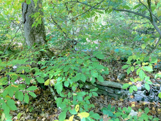
After entering from Michelle Drive, the remnants of the road were almost non-existent and it got even harder to discern as I hiked deeper into the woods...

Parts were swampy and sadly there were still bugs (eeecch!) but I did find a stretch that actually resembled a road for a bit!
But then I came upon a house, a paved driveway and a no trespassing sign so I headed back. (No need to confront an angry homeowner who might have a gun!)
Of course on the way back, I got off course and  basically didn't know where I was  - although I eventually figured after bushwhacking a lot that I was too far east...
But what the heck--the scenery was nice!
-Short Video-

Hindsight is Insight! (Maps)

I intended to track my wanderings but messed up on the way in <sigh>  -- I failed to turn on the  GPS tracking on correctly--duh!

Fortunately using GPS Visualizer I was able to make sense of my wanderings. The yellow dashed route on the map below is pretty much what I hiked which I've manually drawn by hand. What's cool is that the ArcGIS(Clarity) background tiles kinda show the road remnants and overgrown trails!

The OpenStreet-relief  background and even the default Google Street background (at the highest close up setting) shows the property lines of the old road:
Its a wonderfully hilly area with large amount of granite outcroppings.

Oh well - it was still an interesting adventure and my curiosity was somewhat satisfied...


Back to Brainard Pond

This lovely spot is just down the road and warranted another visit, Even though it was a bit cloudy - the pond and dam still looked beautiful!

-Short Video-

I'll return in a week or so when the autumn colors should be a their peak...

Saturday, October 9, 2021

Back to the Abandoned Quarries

I was really curious about the old quarry carriage road I discovered on my trek here on Oct. 1st and I scoured the internet for any old maps that might show them and found nothing. Being a bit obsessed I discovered by changing the historgam on the ArcGis Topo Map, you can get traces of the trails!

Below is the tweaked ArcGIS map with my treks and quarries locations added.

And here’s a rough GPX of my hikes (both days)

I parked at the end of Raymond Road and hiked down a very steep gravel path into the deep ravine. I could see a slag pile up the hill off to the left.

There was a curved uphill carriage road on the right which eased the ascent to the top of the other side of the ravine.

The Old Road past the Quarries

I rejoined the road I explored on my previous visit here and kept hiking north.

Abandoned Machinery

I saw a few artifacts from yesteryear along the way :-)
Refrigerator!

Interesting Rock Formations

I have always found granite outcroppings and rock formations interesting and this area didn't disappoint!
It looked like a soccer ball!

 I am fascinated by old abandoned roads...

Thursday, October 7, 2021

Quickie at R.H. Collins Preserve

I happened upon this small park while sniffing around the area for abandoned roads...

Interesting Bizarre Trees...

Ancient stone walls must have delineated property lines way back when...

Homestead Ruins

As the kiosk indicated, there were old homestead ruins here.
Right nearby were remnants of another building:
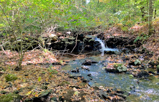
and a vaguely discernible small dam:
As I hiked further, the trail practically disappeared due to a massive tree fall

Carriage Road

And yes I found the vague remnants of an old carriage road...
Kinda cool!

Dam Remnants
As I continued my hike along stream on the Red Trail, I also found what's left of an old dam!