Sunday, October 23, 2016

Woodway, PValley and Sleepy Hollow

Sleepy Hollow Park

I was a beautiful day (midweek) and I wandered over to check out Sleepy Hollow in Springdale. The pond was nice (ducks are highlighted) but the trails are almost non-existent. There is potential here --not for biking - just cut some better trails thru out the woods...
Sleepy Hollow Park - Springdale
Woodway Park
Almost every time I head in here - I see deer. We've kind of stuck up a friendship!
Deer Encounter - Friday Lunch Hour Ride
Deer Encounter - Sunday Late fternnon

Trumbull - Pequonnonck Valley

It's been ages since I been here but I got back for a quick ride on Sunday afternoon. Sadly, the fall colors are past their prime. The leaves were everywhere! It's a good thing I know the trails so well because at times they were almost impossible to see!
The "Burma Road" 
Under the Green Monster
Looking south over Rt 25
Kinda sweet!

Sunday, October 9, 2016

Hawkwood Estate - Burnt Hills, NY

What a brilliant addition to the area’s parks. From my quick ride thru on Sunday morning, it appears that the town is making this a major destination with a large parking lot and a fairly extensive trail system being developed.

I mountain biked in on the White Trail and continued on the Yellow Loop on the back of the park.
Parking Lot
Entrance - White Trail
First Footbridge
The White Trail
Mansion Remnants (orange fencing protects archeological dig)

Historic Photographs


Second Footbridge (too narrow for the bike!)
Yellow Trail
Chimney (different location than the mansion ruins)
Heading back on the long "thoroughfare"
Tree growing thru old car chassis

Further Info

Ballston buys historic Hawkwood property

Hawkwood - PDF (written by Town Historian Rick Reynolds)

History Lesson: The Baker Brothers made their home in Ballston

Hawkwood Photos

Friday, October 7, 2016

909 Bust

I took Friday off to ride 909 on the way up to visit my mother. The weather was absolutely incredible - sunny and in the 70s. Just the shorts and a jersey was all you needed. I decided to finally ride BykHead -- the only time I rode it was years ago with my son.

I parked at the Tyrell lot and made a beeline south on Brockway, veering on Tent. I meant to turn off on Mary Murphy but somehow I missed it :-(.  Once I got to the main dirt road, I turned left and headed uphill past the chimney and found the other side of Mary Murphy (after continuing a bit too far on Anthill!). Mary Murphy is a great trail for XC. I ended looping back and crossed the dirt road to get on BykhHead. Once I got past where the other old log road crosses it (brown trails on the map), I recognized the climb I did with my son ages ago.

It was a tough climb but once the main steep part ends, you are rewarded with a great, great trail. After a bit of exhilarating riding - I hit a small rock and the back wheel froze! Bummer--the axle came out!!

I tried hard to put it all back together but somehow I couldn't. I also wrongly assumed I was missing an end bolt on one side. Can you believe it? I was finally on ByHead again over a decade later and my bike was inoperable - man I was bummed. I had to walk out of the park with the bike.

I tried slinging the back of the bike off the ground with my arm and helmet chin straps, gingerly walking my bike using sticks as an temporary axle to hold the wheel in place and finally simply propped the bike on my shoulder and walked for the next hour and half or so!  It of course felt like an eternity!
BykHead is the best!
These photos can't/don't capture the magic of this trail
Temp solution only!
Man - if only I was riding this!
Carrying my bike for seemingly forever...

Fortunately, I stopped at a great bike shop "Plaine & Son" in Schenectady a few hours later and they were able to fix the bike. :-)

Sunday, October 2, 2016

Mapping Quarry Head

After two visits to help build new trails for this park, I decided to return and hike the Quarry Head section and GPS the trails.

Prior to becoming a park, this parcel of land was a summer residence for the Degener family from the late 1920’s through 1988. The well preserved foundation and fireplace adjacent to the parking area was abandoned only in 1988 hence its "fresh" appearance. Here's a panorama of the parking area and remnants of the house foundation (click to enlarge).
Panorama
aerial of the abandoned residence and parking area
(the new Red trail is indicated)
 As this topo map indicates, there are significant elevation changes in the park.

Today I hiked and GPS'd these trails (first the Red Trail and then the Yellow connector to the White Trail Loop).

Descending on the new Red Trail

This is the section we worked on last Saturday. Kudos to Dave Francefort for picking out quite a few scenic rock features to make it interesting...
This section was just built last week
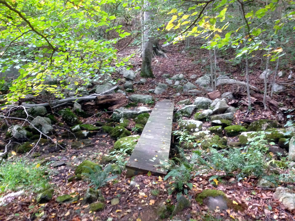
Once at the bottom. you can head across a footbridge over a rocky (dry) streambed and head north.  This is a fairly rugged trail. Below are photos of two more footbridges on the north loop.
 Most of the trail is fairly rough and granite strewn but for a short bit it is boulder-free and flat
 One more foot bridge!

It took me a while to figure out why the kiosk wasn't making much sense. Turns out the red paint for the Red Trail was missing. I have digitally added the Red Trail on the photo below. The main Yellow Trail is being closed due to the serious erosion issues.

White Trail Loop

The White Trail loops around north of the kiosk. It is a much easier trail..

Where the White meets the fire road there are some great granite remnants of the old quarry. Quarry operations ceased at the turn of the century but during the 18th century, the quarry produced millstones for grinding rye and corn in local grist mills. During the 19th century, gneiss was quarried for use as steps and foundations for buildings in the area.  Gneiss is a metamorphic rock, generally made up of bands that differ in color and composition, some bands being rich in feldspar and quartz, others rich in hornblende or mica.
Note drill holes
 From this point, its a short jaunt on the fire road back to the parking lot.

Further Info:


Sunday, August 28, 2016

Trapp Family Trails


The Lower Trails

On Sunday, I rode the lower trails in the early morning, starting with a quick bomb on the easy Greenway (which was closed halfway so I guess the cows could graze!), then I rode Stepping Stones, the Aither trail and Chuck's Corkscrew in both directions. Great trails - especially when ridden fast :-)

For the rest of the morning, I went out for a hike with my sister over at Waterbury to check out the abandoned settlement there.

In the mid afternoon, I hit the lower trails again, this time also riding the Sleigh Road to get over to the brewery area. That has a huge descent/climb but it got me to the top section of Pipeline which I rode all the way up to the road. Someday--if I am brave (or crazy)--I  will attempt the full descent to the High School but a car waiting for me at the bottom would be a necessity!

Basic Trail map of the area
This is a map form last year...
Small waterfalls off Sleigh Trail

Lodge Spur, Luce Hill and Tapline

Monday Morning, I climbed up Lodge Spur, rode ALL of Tapline and on return, did the Luce Hill Loop. 
Descending Tapline and riding Luce Hill Loop

Tapline and Luce Hill Loop

Descending Lodge Spur
Lodge Spur
Certain sections had a lot of lines wrapped around trees - Maple Syrup in the fall!
Tapline!
Upper Tapline was tough! The switchbacks were very tight and after he climb for one stretch of about 5 switchbacks I was winded. (But of course the way back down was crazy!)
Upper Tapline
Yikes! this was tough - many tight switchbacks
My destination was a new trail called Growler that continued up the mountain. Bummer - I couldn't find where Growler started so I headed back :-( (I found out later it required a ride up further on either of the Parizo Trails)

Took a spill on Luce Hill Loop...
Oops!
All in all, I had some great rides and these trails are wonderful...